CLIMBING FROM PICO DO ARIEIRO TO PICO RUIVO – MADEIRA’S HIGHEST PEAKS
This trail between Pico do Arieiro and Pico Ruivo, Madeira’s most famous mountains, is an absolute must for every mountain lover!
MIXED FEELINGS AT THE START
Esteem, delight, excitement, nerves and a touch of fear: this is the cocktail of feelings I’m feeling before venturing on this walk today. The last time I walked this trail, I was gasping for oxygen and nearly suffocating in coughing fits….. It later turned out I was suffering from whooping cough. I remember very well how this walk left me out of breath. But, no whooping cough this year, so it surely will be a lot easier than last time! Besides that, I also remember very well how breathtakingly (pun intended) beautiful I thought this trail was. That’s reason enough to give it another try!
START OF THE TRAIL: PICO DO ARIEIRO
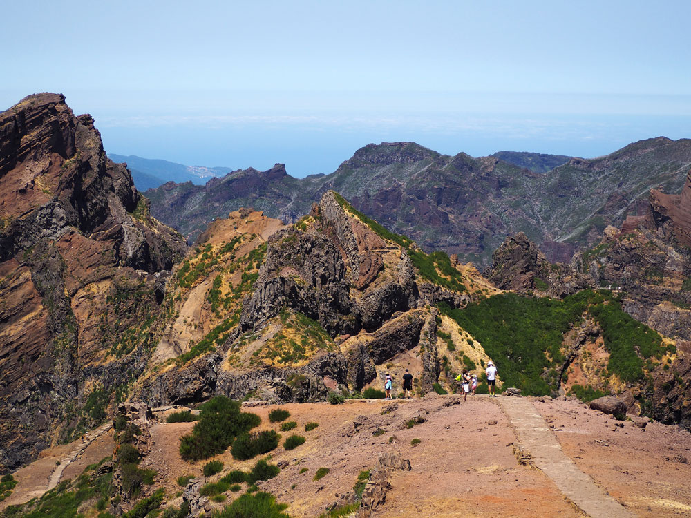
The trail starts at the second highest mountain of Madeira, at 1818m high on Pico do Arieiro. Standing on top of this mountain means beautiful vistas in all directions. From here you can see the volcanic peninsula Ponta de São Lourenço, Ilhas Desertas islands, the Paúl da Serra plateau and of course all the high mountains directly surrounding Pico do Arieiro. Needless to say, you require a clear sky to be able to see this far, or else you’ll see only clouds. Pico do Arieiro is a great location to see the sun set on Madeira. Early birds can participate in special tours, dropping you off at Pico do Arieiro while it’s still pitch-dark. We are not that early, but still early enough to avoid the crowds. This trail is very popular and can get pretty crowded, especially during high season.
FIRST PART OF THE TRAIL
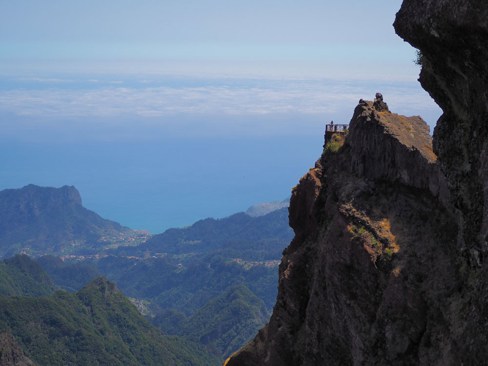
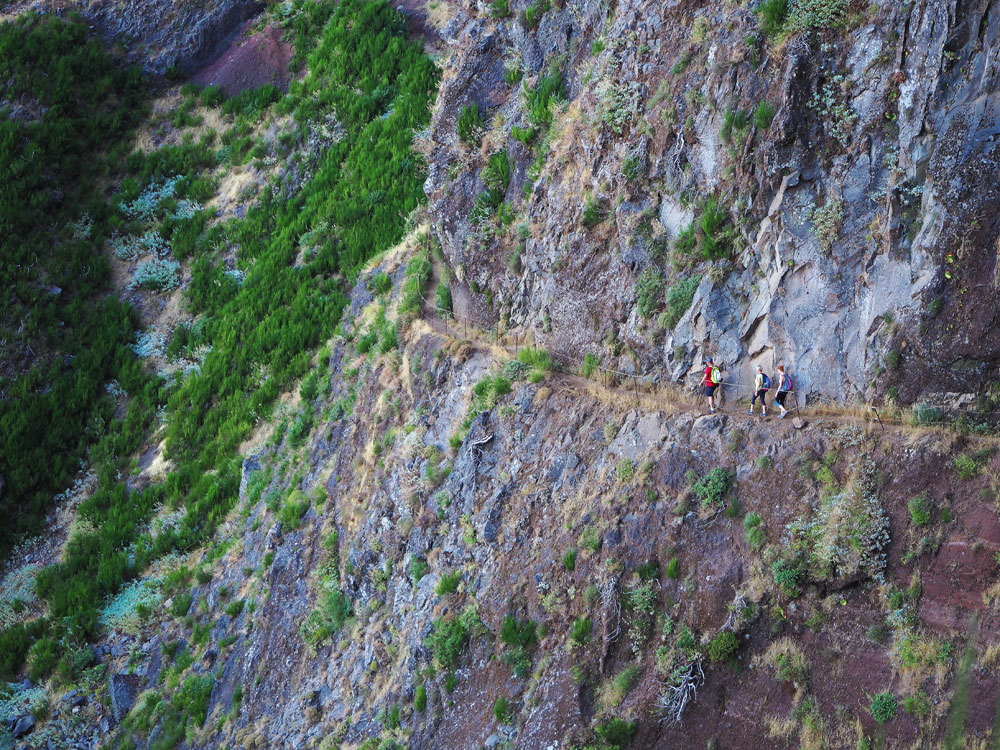
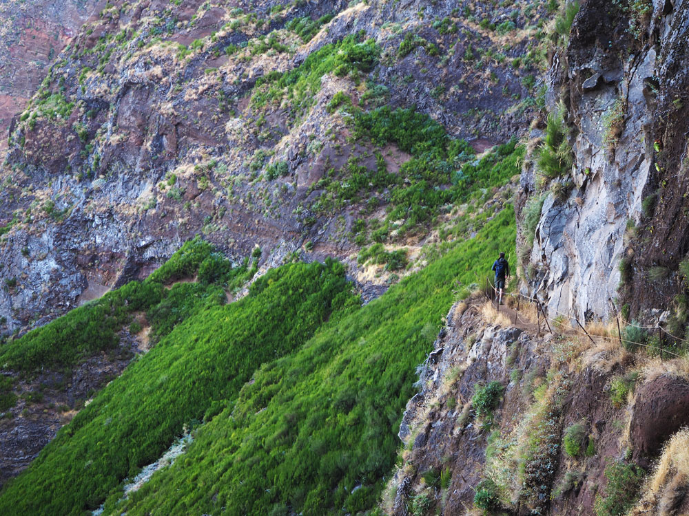
Here we go! The trail leads us over very old, narrow paths and steep steps. For hikers with a fear of heights: better not look down!
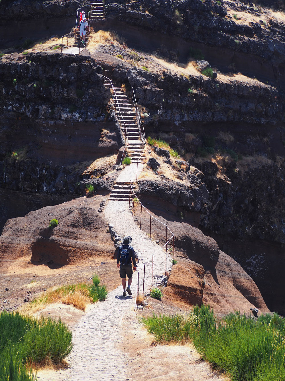
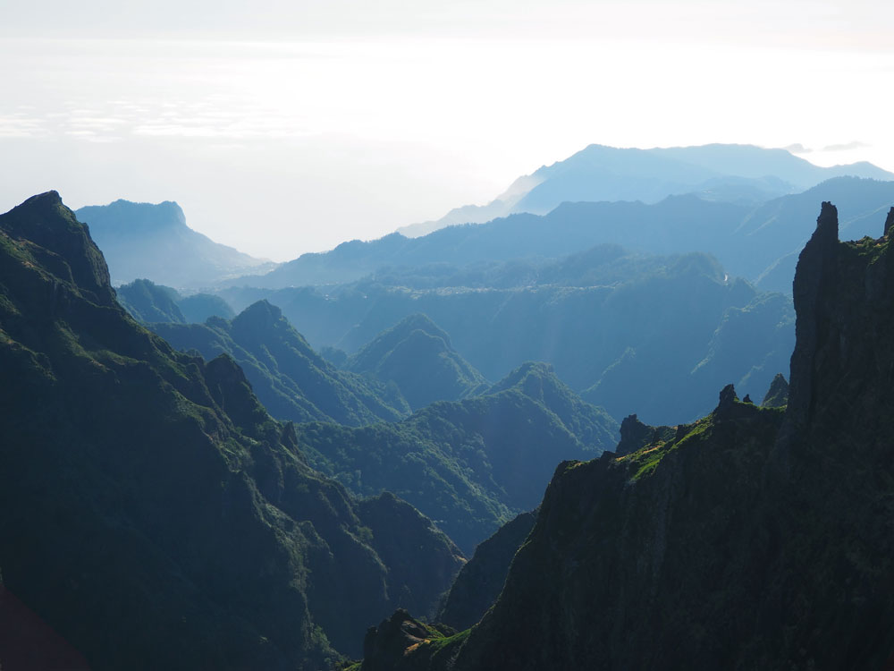
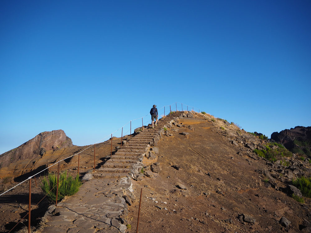
Views on the central plateau, the ocean, massive mountain peaks in grey, red and brown and dizzying abysses: this trail will give you all of that. We are here in the middle of summer, so most of the flowers are withered, but during spring yellow and purple flowers are everywhere. Some parts of the trail are so very narrow, you’ll be tempted to hug the safety of the solid wall next to you and never let go ;-). The ‘protective’ railings on these paths aren’t always in perfect shape, so please be extra careful there. At around three quarters into the trail a part of the original path is damaged so severely (probably by fallen rocks), steel stairways were placed to climb up that part of the mountain. These stair are steep! Fortunately, the railings feel pretty solid, so I hoist practically hoist myself up the mountain. I am not the only one: many a hiker is taking time to enjoy the view (or: catching his/her breath) at the top of the stairs, before continuing on the trail.
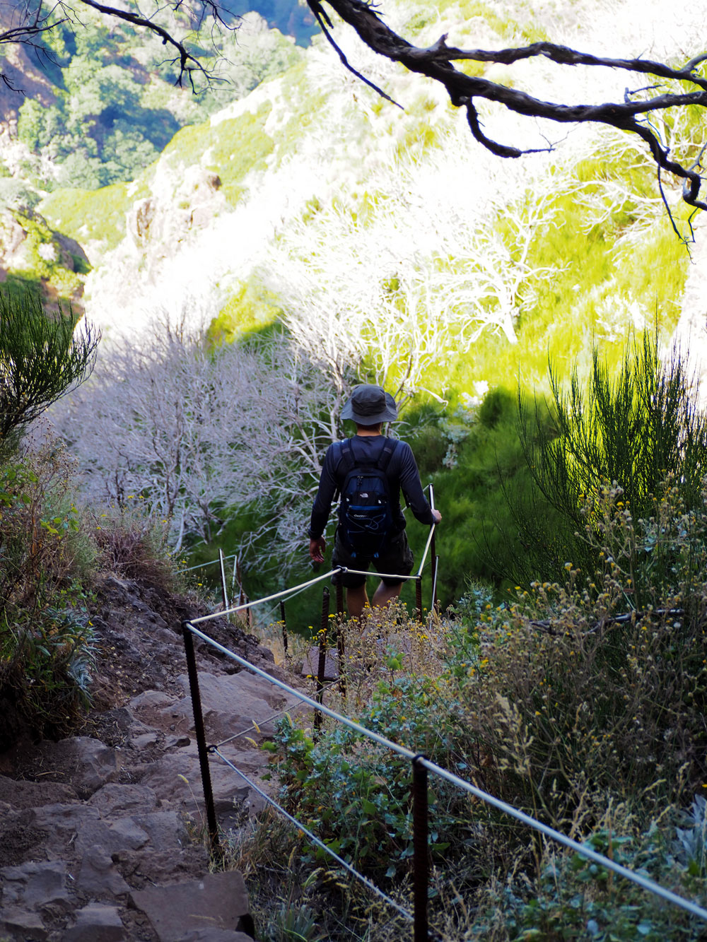
THE FINAL CLIMB TO PICO RUIVO
A large fire ruined parts of this area a couple of years ago. Although it is a very great loss that so much nature was destroyed, the many burned, white trees on the mountain ridges give this area a very unique and surreal appearance. You’ll see a lot of these trees on your last climb up to Pico Ruivo. The view from Pico Ruivo is fabulous. You can see 360 degrees in all directions. That is, if you’ve started this walk early in the day, because as the day progresses, clouds often creep up the mountain, cloaking your view. Another good reason to start early in the day!
PRACTICAL INFORMATION
This is a stunning, diverse and pretty strenuous walk. Definitely worth the effort though! Bring a wind jack, even during summer, because it can get pretty cold very sudden. There are several tunnels on this trail, so a small flashlight will definitely come in handy.
ROUTE PICO DO ARIEIRO – PICO RUIVO
Pico Arieiro Pico Ruivo
Profile
No data elevation
Name:
No data
Distance:
No data
Minimum elevation:
No data
Maximum elevation:
No data
Elevation gain:
No data
Elevation loss:
No data
Duration:
No data
Description
Add here your formated description