HIKING ALONG BOAVENTURA’S COAST
Boaventura is a small village on the northern coast of Madeira. In the direct area of this charming little village you’ll find some very nice and more unknown trails. Unlike on some of the more crowded trails on Madeira, on these ones you’ll be able to enjoy your surroundings in complete peace.
STARTING POINT OF THE WALKS
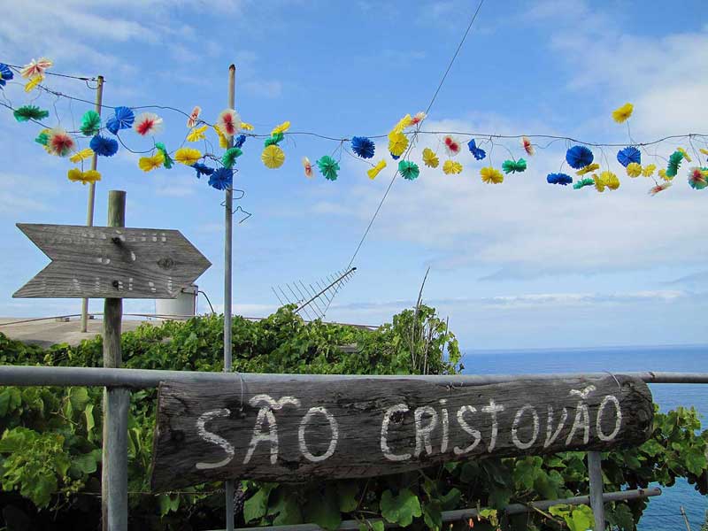
One of the trails in this area starts near Restaurant Sao Cristovao: at the crossroad just above the restaurant are some houses and a water fountain. Next to these houses, you’ll see a small path: that’s your starting point! Take a good look at the photo I posted: although the text is very faded, there is a signpost pointing to the start of the walk. This is quite a tricky starting point. Some years ago, you could start the walk on a path directly next to the restaurant, but nowadays this path is overgrown and inaccessible. Many walking guides still mention this path though. Result: lost hikers throwing themselves right into a wild bush of corn next to the restaurant. Trust me, the easier way is to go back up the road to the crossroad and just follow the path from there. Attention: one of the GPS tracks at the bottom of this page still displays the old path next to the Restaurant, use the starting point of the other GPS track.
TWO COASTAL WALKS
Starting at the correct path, you’ll descent a winding cobblestone path and end up at a stone bridge over Ribeira do Porco. On the other side of the bridge, you can choose one of two walks: climb up a steep cliff path leading to Arco de Sao Jorge, or take the old path to the left which leads to the ocean. Both options are very nice walks! Since both walks are quite short, you can also choose to do both.


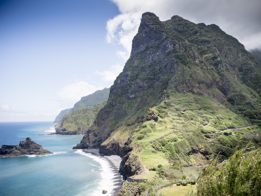
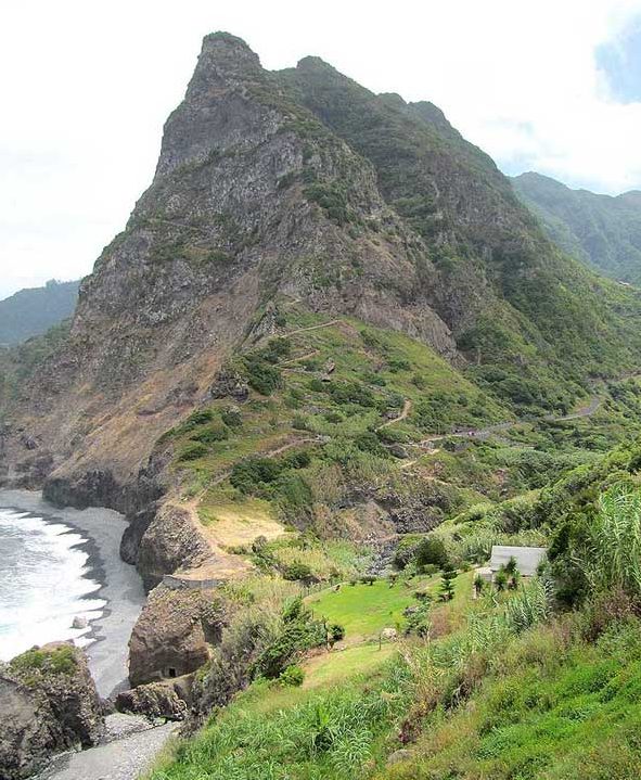
The walk to Arco de Sao Jorge offers amazing views over the ocean while you’re ascending the old paved path up the cliff. The walk itself is not very hard, but when we walked this route last year it was mid-summer and the sun was burning heavily. Better to do this walk early in the day or at the end of the day, when the heat is less intense. If you choose to walk the old path to the ocean, you go left directly after you cross the bridge. The first part of this path seems a bit of a challenge: you’ll see a very narrow sand path next to a rock wall. It looks worse than it actually is, though. After the first few meters the very narrow path broadens and the rest of the path is very good. The path leads to some old ruins: appears to be the remnants of an small village. At the end of the path you’ll find yourself on a very peaceful stone beach.


PRACTICAL INFORMATION
The two walks described here are easy and short walks, which can easily be combined with another walk in the area. Both walks include some ascends and descends, but you don’t have to be an experienced walker to be able to complete these walks. Regarding the route to Arco de Sao Jorge: this climb can be quite demanding in hot weather, so if you’re walking this route in summer I recommend starting early in the day or at the end of the day. Exercise makes hungry! If you need to recharge after finishing these walks, I recommend a visit to Restaurant São Cristóvão. From their terrace you can enjoy a great view on the mountain path to Arco de Sao Jorge and the ocean. Furthermore: they serve some very tasty food!
ROUTES
Route # 27b in Sunflower Guide
Boaventura Arco de Sao Jorge
Profile
No data elevation
Name:
No data
Distance:
No data
Minimum elevation:
No data
Maximum elevation:
No data
Elevation gain:
No data
Elevation loss:
No data
Duration:
No data
Boaventura Coastal hike
Profile
No data elevation
Name:
No data
Distance:
No data
Minimum elevation:
No data
Maximum elevation:
No data
Elevation gain:
No data
Elevation loss:
No data
Duration:
No data